江苏科技信息 ›› 2019, Vol. 36 ›› Issue (3): 42-46.doi: 10.1004-7530/2019-36-3-42

• 应用技术 • 上一篇    下一篇

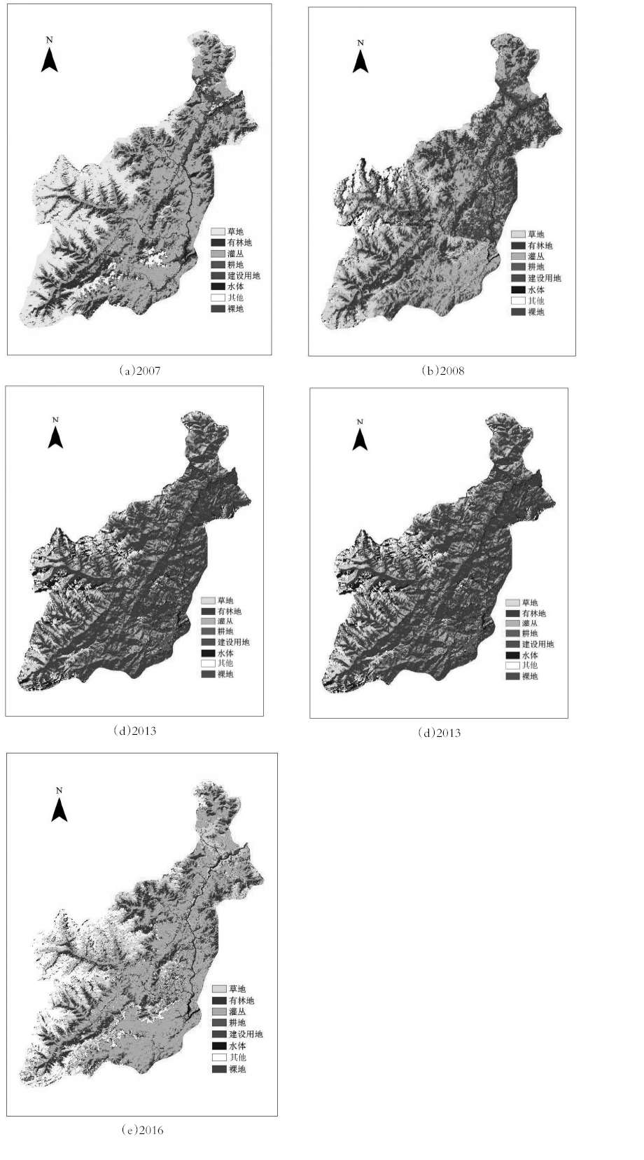
基于Landsat影像的地震灾区林地动态变化监测研究

宁勇伟1,刘欣2   

  1. 1. 河南理工大学,河南 焦作 454000
    2. 河南测绘职业学院,河南 郑州 450000
  • 出版日期:2019-01-30 发布日期:2019-07-09
  • 作者简介:宁勇伟(1992— ),男,河南三门峡人,硕士研究生;研究方向:摄影测量与遥感技术。

Research on dynamic monitoring of forest land in earthquake-stricken area based on landsat image

Yongwei Ning1,Xin Liu2   

  1. 1. Hennan University of Science and Technology, Jiaozuo 454000, China
    2. Henan College of Surveying and Mapping, Zhenghzou 450000, China
  • Online:2019-01-30 Published:2019-07-09

摘要:

遥感技术凭借其高效性、时效性、大范围监测等优势已广泛用于森林资源变化监测。文章基于五期Landsat影像,结合光谱特征、植被指数,采用支持向量机法、分类后比较法对地震前后林地的变化进行了监测。结果表明:各期分类结果总体精度均大于75%,Kappa系数均大于0.7;2007—2008年林地呈减少趋势,2008—2016年林地的变化呈现增长趋势并缓慢的恢复到震前水平。

关键词: 地震前后, 变化监测, 分类特征, 遥感分类

Abstract:

Remote sensing technology has been widely used in forest resource change monitoring due to its high efficiency, timeliness and wide-ranging monitoring. Based on the five-time Landsat image, combined with spectral features and vegetation index, the support vector machine method and post-classification comparison method were used to monitor the changes of forest land before and after the earthquake. The results showed that the overall accuracy of each classification was greater than 75%, and the Kappa coefficient was greater than 0.7. The forest land showed a decreasing trend from 2007 to 2008. The change of forest land showed a growth trend form 2008 to 2016 and slowly recovered to the pre-earthquake level.

Key words: before and after the earthquake, change monitoring, classification feature, remote sensing classification

中图分类号: